Regarded as the holy grail of trekking in the Patagonian Andes, we were super excited about this component of our trip. It has also formed a crucial part of our trip planning (although very loose), being just at the end of the winter low season, meaning fewer trampers, and easily navigable paths with the snow melt well under way.
 |
| Yep, it's definately the other left |
Hiking East to West (In a Big W shape), allowed us to view the Torres (Towers) in their full glory on day one, and with the campsite at their base an obligatory sunrise viewing on day 2.
We were incredibly lucky with the weather as we'd heard it was possible to hike for a week in the park without seeing the Torres. Our first viewing was shared with chilly wind and a spot of snow, and sunrise was a bluebird - once in a fortnight day! The locals at Puerto Natales laughed when we asked what the weather forecast was looking like for the week - explaining the unpredictability of the area.
 |
| Horses are literate in Chile |
 |
| Day one hike up to the Torres from camp at the valley base |
 |
| The expedition team - Helen, Marc Clare & I |
 |
| The granite monoliths of Torres del Paine - Sur 2850m, Central 2800m, Norte 2248m. Torre Central towers 1000m above the snow line |
 |
| Dia 2 - Bonita chica, bonita vista, bonita dia! |
 |
| Pointing out the frozen lake at the Torres base, from which we made porridge. |

 |
| Walking out of the first arm towards Lago Nordenskjold |
Day 2 was our largest, with 26km starting at sunrise. We soon discovered there were numerous other lakes, rivers and mountains equilly spectactular as the spires the park is named after, only we had not seen or heard of them previouisly so these were an added bonus.
 |
| Lago Nordenskjold y Glaciar Gray |
 |
| Cuernos del Paine |
 |
| Cerro Paine Grande Avalanche Mountain, viewed from camp spot 2 |
It was here we met some classic and most enthusiatic Chileans, the Pisco Sour we had hauled in thus went down extremely well.
 |
| Cerro Paine Grande |
 |
| Telephoto zoom ofcourse! |
 |
| Half-way celebratory scroggin stop, Mirador Britanico |
 |
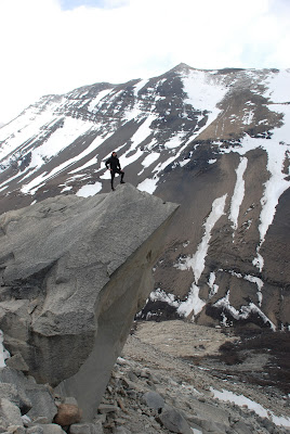
| The third and final arm of the W took us along Lago Grey to the stunning Glacier Grey. |
 |
 |
| Part of Cerro Paine Grande |
 |
| Southern snout of Glacier Grey |
 |
| Drowned trampers at the finish line |
 |
| The beginning of the evenings celebrations back in Puerto Natales - Argentinian style beef de carne, papas fritas y el vino tinto, delicioso! |

No comments:
Post a Comment